Yesterday was supposed to be only 22 km, but it went longer—way longer. Try 36K. I'm staying two nights at my current motel as a result.
Stats:
Distance: 36 km
Time: 593 minutes (about 3.6 kph)
Steps: 56,884
Calories Burned: 6,736
Calories Consumed: 5,293 (deficit = 1,443)
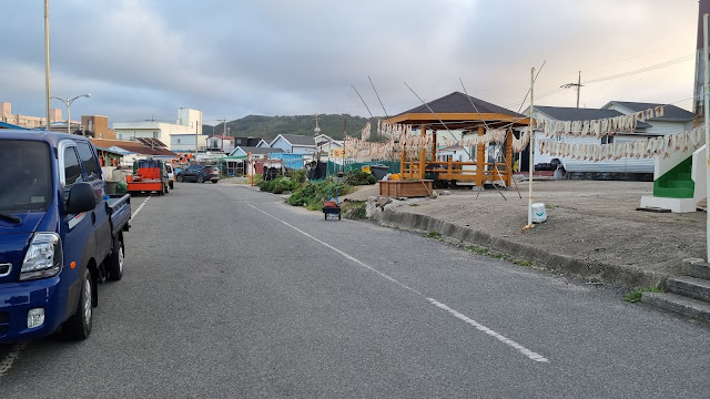
The first two-thirds of yesterday's route to my scheduled pension were flat. They were also all about getting out of downtown Pohang. I'm still technically in Pohang (having gone from 북구/Buk-gu to 남구/Nam-gu), but I'll be completely out of here and in Gyeongju two walking days from now. Even though the walk to my scheduled pension was barely 22 km, it felt like a lot more, and then I ended up not going to that pension, anyway, as I continued down the road to another lodging. The next several kilometers of the day's walk took me more or less along the coastline, and the terrain was hilly for that part (naturally). The very last few kilometers saw me back directly on the coast, with the wind and whitecapped waves, and with very few hills in the way.
No cert centers encountered, but keep in mind that I initially started downtown before belatedly moving to the water's edge, so I missed a few kilometers of bike path where a cert center could have resided. I saw some spots where a cert center would have been nice, but I don't determine where cert centers go, so my opinion counts for nothing.
I think I'm on what's called the Homi Peninsula (the hanja for Homi means "tiger's tail"), which juts out prognathously from the south side of Pohang. It took most of this morning to leave behind the noise, pollution, and traffic of the big city (as well as, alas, its conveniences), and while I'm happy to be back to where things are a bit quieter, I'm worried that, from here to Busan, things are going to be intensely urban. Fears of a megalopolis return as I ponder the rapid succession of major cities on my path: Gyeongju and Ulsan both loom ahead before I even reach Busan, and the final day of my walk basically sees me cutting across Busan to hit the Nakdong River cert center. No final view of the ocean until I'm done and take a cab to Gwangalli or Haeundae for a triumphal stroll along the strand.
More immediately, there's tomorrow's rain, and from what I see on Weather.com, rain on and off until the end of this walk. Will the whole thing end as a pisser? I guess we'll find out together. Luckily, I'm weathering the rain tomorrow by sheltering in place. You heard that right: I'm staying where I am for two nights.
So here's what happened. I was originally supposed to walk 22 km to Ara Hill Pension and stop there for the night. I got to the pension and tried calling, but no one answered, and there seemed to be no one home. I waited awkwardly for several minutes as I pondered my next move, then finally decided to just keep on walking along the coast. I did see on Naver Map that the New Millennium Monument was down the road; you may even have seen the famous image of a pair of giant hands reaching up out of the ground. I figured that this would be a huge area for tourists, so there ought to be restaurants, motels, and pensions galore. Turns out I was right, at least to the extent that finding lodging and food was easy.
So I marched an extra 14 kilometers, quite without realizing I was going that far, all the way to that monument. The hand sculptures turned out to be big, but not as big as they seemed in all the pictures. Once I figured out I had walked 36 kilometers, a couple of things occurred to me. First was how little I hurt. In the past, marches of this length have basically wiped me out, but this time, while I was pretty tired, and my feet hurt a bit, I was doing a lot better than I'd done on previous walks. Second was that I had come far enough to make the next day's walk extremely short, so why not rest two nights, instead, and figure out how to distribute the remaining segments of the walk.
So that's where things stand. I'm publishing this entry after midnight, so it's the following day. Now you understand why I label my posts with both "day" and "leg": because something like yesterday can happen and necessitate an extra day of rest, which throws off the numbering.
I think I've figured out a way to still end the walk on October 13, even though I have the cushion of a couple extra vacation days to allow me some flexibility. The next two walking days will both be over 30K, and then I can follow my original schedule, only minus one leg. So this trip now becomes a 25-legger instead of a 26-legger.
Spending the morning walking in downtown traffic sucked. The air in that part of Pohang actually smelled bad, and cars, trucks, and buses all kept roaring by. Bikers would blow past me, too, although they tended to be polite about it, calling out a warning as they passed me or using their bells to alert me to their presence.
Pohang is a heavily industrialized city, so the skyline is, in some sections, defined by smokestacks and giant plants and warehouses. There was a very "Blade Runner in the daytime" sort of feel as I was passing through. I found bits of art and nature to photograph here and there, but overall, I'd have to say Pohang is a pretty ugly city. It really was a relief to finally get away from all the traffic and go back to the relatively quiet seaside. There were still cars to contend with along the back roads, and no road shoulder, in many parts, to keep me out of the way of drivers, but I survived and felt the inconvenience of occasional car-dodging was worth the lack of noise and pollution. Everything is relative, right?
Ultimately, I made it to the monument by 5:30 p.m., so there was still plenty of daylight. I figured out the distance I'd walked, took a massive piss in the restroom on the grounds, unloaded a slew of empty plastic bottles into the recycling, took photos of the monument's various buildings and displays, and ate two waffles to celebrate 36 kilometers of hard walking.
A motel called Hanna (한나) turned out to be right behind the restaurant where I ate dinner; the old man who greeted me at the motel was both hard of hearing and a little confused: when I told him I planned to stay two nights (W80,000), he asked after a pause, "So there are two of you?" When he gave me the key to a first-floor room, it turned out there was someone in the room, just sitting on the bed and eating dinner. That guy skedaddled, but the smell of his food lingered after he left. Anyway, the room is mine for two nights, now.
I'll upload the photos at my leisure once I wake up in the morning. I'll be sleeping in, as you can understand, so if I get the pics up by noon, it'll be a miracle. I think this worked out well, overall: I get to avoid Wednesday's rain. Thursday is supposed to be partly sunny and hot. It's been hot for most of this walk thus far. I might actually look forward to rain after Thursday.
Good God... will Gyeongju and Ulsan be this bad?
PHOTO ESSAY
 |
| We've got over 600 photos for this one, so buckle up. |
 |
| 5:30 a.m., and plenty of drivers have obviously woken up well before I did. |
 |
| I saw this alley and reflexively thought, "I wouldn't want to die there." |
 |
| Savor the Konglish. |
 |
| This would prove to be an omen. |
 |
| Somewhere around this point, I've decided not to follow Naver and to head straight for the water's edge. |
 |
| moving into a wharf area with plenty of odors |
 |
| coquilles |
 |
| chair and bike caught having illicit affair |
 |
| killer whale |
 |
| By this point, I'm already pretty sick of all the traffic and the sheer urbanness of it all. |
 |
| several places in this area named "Seong Mo" (Holy Mother) |
 |
| another Chinese place |
 |
| I thought this might be a Buddhist bodhisattva figure at first, but the angel wings make this probably Christian. |
 |
| Whatever the figure is, it's guarding a hotel. |
 |
| approaching the big water |
 |
| ta-dah! |
 |
| best I could do for sunrise |
 |
| the benefits of walking, explained |
 |
| walking inland toward a bridge a few kilometers away |
 |
| Pohang is synonymous with heavy industry |
 |
| I realized that the actual bike path was down at the water's edge, so I took the above shot and moved down. |
 |
| cosmos keep me sane |
 |
| no guardrail or fence |
 |
| nice pic of rocks in the water, until... |
 |
| ...you notice that one of the rocks isn't a rock |
 |
| am strangely reminded of a restaurant called The Bonefish Grill, which had a similar logo |
 |
| No touch! |
 |
| Despite the ugly scenery, I kind of enjoyed this part of the walk. |
 |
| I've reached the bridge I must cross. |
 |
| a separate lane for us walkers |
 |
| backed-up traffic |
 |
| all these mopeds parked together |
 |
| POSCO, as I discovered, is everywhere in Pohang |
 |
| a rail line |
 |
| entrance to one of several POSCO facilities |
 |
| seen from afar |
 |
| floral respite from all the damn vehicles |
 |
| I appreciate flower-lined bridges |
 |
| briefly wondered whether I'd be walking that creek path, but Naver said no |
 |
| You might not be able to tell from the photos, but it's hot. |
 |
| I'm really not liking this annoying font, which makes "Pohang" look like "Qońang," as if it were Vietnamese. This is what you get when non-English-speakers try their hand at being "creative" with English. |
 |
| rest assured, he's dead |
 |
| my skin vs. beef jerky: fascinating resemblance |
 |
| some sort of pastoral scenario |
 |
| Dad with the plow |
 |
| Mom, kid, and dog |
 |
| a guy saws into the sidewalk, loudly |
 |
| Janus-faced traffic mannequin (note the feet) |
 |
| actual ripe grapes growing along the street (I plucked one; it was good) |
 |
| more grapes, different species |
 |
| aviation museum |
 |
| still on the right track, apparently |
 |
| fahr d'partmunt |
 |
| The Chinese characters say il weol dong, or "sun-moon-district." |
 |
| a flower shop |
 |
| The local Lions Club loves putting up its lions. |
 |
| Pohang has an airport. |
 |
| definitely moving away from all the traffic and noise now |
 |
| thataway |
 |
| moving to the coast now |
 |
| a stream clear enough for you to see its fish |
 |
| des palmiers |
 |
| signs were all over for a "Homi Peninsula loop trail" |
 |
| ladies, working |
 |
| a dog walker way ahead |
 |
| the dog walker sits, so I pass her |
 |
| ugly skyline from the other side of this bay |
 |
| back to seaside fishing villages |
 |
| something about loving the environment and throwing away your garbage |
 |
| I've never seen rebar used as signage before. |
 |
| I do feel some envy when I see these peaceful seaside residences. |
 |
| two kinds of shwimteo |
 |
| moving now to farmland back roads, and hills |
 |
| more barkers |
 |
| Hotel Marine, entrance |
 |
| hill |
 |
| a discarded toshi |
 |
| more hill |
 |
| The "ㅍ" in the "멸치판매" sign is exceedingly strange. |
 |
| We're definitely in hilly territory. |
 |
| arfer doing his duty |
 |
| motel that I briefly thought about stopping at, but it looked empty |
 |
| way in the back, Café Nearby |
 |
| entrance to Café Nearby |
 |
| more hilliness |
 |
| sign for a temple |
 |
| ice blood? sang froid? |
 |
| continuing upward |
 |
| The term haeparang has followed me this entire walk. I guess it means something like "blue sea." |
 |
| Here, the hangeul reads, "Blue Ocean." |
 |
| another tiny house |
 |
| a little taste of Finlandia |
 |
| I suddenly wanted to hop on a tour bus. |
 |
| The large Korean letters say "Bonjour." The small, blue Korean letters say "Americano." Then, there's the US English phrase "take-out." (You Brits say "take-away.") This is a linguistically confused sign. |
 |
| big hill coming up |
 |
| And here's the Ara Hill Pension, where I thought I'd be staying, but nobody answered the phone, and no one seemed to be in. Onward, then. |
 |
| The red sign is for Classic Pension, which I decided I'd visit. |
 |
| road leveling out as we move into town |
 |
| Classic Pension was also closed for business. I snapped some shots of quirky doodads decorating the pension. |
 |
| After grabbing some food, I sat down to lunch in the shadow of a grounded boat. |
 |
| moving on again |
 |
| that annoying font |
 |
| a shrine-like shwimteo |
 |
| an actual shrine |
 |
| my first look at harvested rice laid out to dry |
 |
| Somewhere between here and the previous picture, I stopped in at a tiny store to buy some drinks. The old grandmother running the store was obviously a stroke victim, unsure on her feet, and constantly needing to hold on to things for balance. I felt sympathy for her. |
 |
| a Presbyterian church |
 |
| hilly, hilly |
 |
| and down again |
 |
| dudes having a swim |
 |
| a far-off ship |
 |
| digital zoom scores again |
 |
| gull, arrogant |
 |
| So was the rock in the previous photo the Janggun Bawi (장군바위)? I only vaguely remember the story of how some clever Koreans scared off some Japanese attackers by dressing a rock up as a feared general or admiral. Comment below if you remember the story right. It's been years since I thought about it. |
 |
| Somewhere around this point, I've checked Naver Map and have decided to make my way to the New Millennium Monument, which is about eight kilometers from this point. It's getting close to 3 o'clock, and I'm moving more slowly now, having passed my original destination a while back. Do I have enough in the tank to make the trip to the monument? I do some internal figuring and decide that I do. |
 |
| 1.2 kilometers of steep slope ahead |
 |
| stop waving your sexy butt in my face |
 |
| nearing the top of this rise |
 |
| The top two syllables are the Chinese characters ho and mi, or "tiger" and "tail." Below is the Korean phrase 사랑숲 (sarang-sup), which if we're literal about it, translates as "love forest." That sounds kinky in English, but I think the idea is to express a love of nature (or of tigers?). |
 |
| Google Translate renders 곶 as "headland," which makes me think of a jutting promontory. I'm guessing this sign says Tiger Tail Headland Village. |
 |
| another sign warning of a slope, this time going down |
 |
| I threw in the can free of charge. |
 |
| leveled out once again |
 |
| more crab pots than you can shake a dick at |
 |
| raw-fish menu |
 |
| The ship in the distance seems to be empty, judging by the high waterline. I'm just guessing, though. I know nothing about cargo vessels. |
 |
| mysterious structure of power |
 |
| this stretch was nice, except for the occasional car-dodging |
 |
| a short hill |
 |
| turned out to be long and steep |
 |
If I'm reading this right, the sign is warning of landmines in the forest. Why would you mine the high ground that you'd need to retreat to in the event of a tsunami?
|
 |
| These shuttle buses are everywhere, so I finally decided to photograph one. |
 |
| up we go |
 |
| then radically down |
 |
| moving into town again... from here to the end, the walk is pretty flat except maybe for minor rises |
 |
| glove on a sea wall |
 |
| I hate glamping, ... |
 |
| ...but I can't look away. |
 |
| God help me. |
 |
| Who names their pension "Beached Whale"? |
 |
| Somewhere before this tableau, I ran across a 7- Eleven and decided to tank up on drinks and snacks. Then I found a shwimteo and sat down to eat and drink. Hiking leaves you hungry. Those crabs, meanwhile, seem so utterly random. |
 |
| An old, muttering lady came out with this tub of squid. She set the tub down and left. I assume she came back after I had gone. |
 |
| At this point, I'm less than two kilometers from the monument. |
 |
| I've seen the Korea-as-tiger thing before, but it pays not to stare too long at the tiger's butt. |
 |
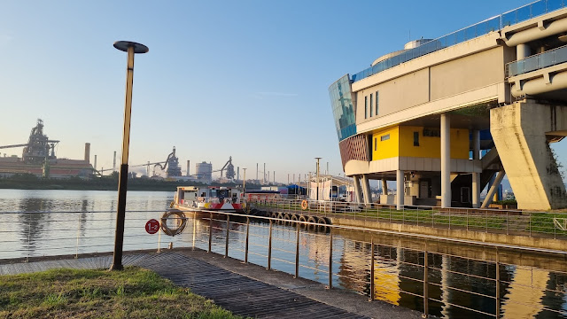
| the monument grounds! |
 |
| note the abstract rendition of supporting hands |
 |
| miniature version of the big sculpture |
 |
| main building from the back |
 |
| I don't |
 |
| one hand of two |
 |
| God pats me on the head |
 |
| lighthouse, obscured |
 |
| the second giant hand, which gulls seem to love perching on |
 |
| moving into dusk (I had arrived at 5:30) |
 |
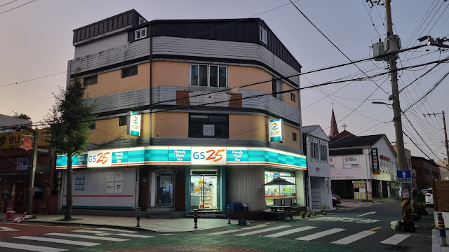
| terrible location for a convenience store |
 |
| dinner just across the way |
 |
| a simple meal of donggaseu (Korean schnitzel) |
 |
| Hanna: my motel for two nights |




















4 comments:
Impressive, in a Great Escape kind of way. I think exercising that kind of flexibility in plans and your re-established durability gives you a type of control over this hike that works to your advantage. An extra day of rest on a rainy day is a great reward for your efforts. 36K! Wow!
Here's hoping that Pohang is the bad example and the next two metro areas have their shit together. I'm curious though why Seoul is so appealing in comparison. It's bigger and more densely populated, is it all about the type of industry the cities feature?
Seoul isn't industrialized, and it's also a cosmopolitan center of culture. That said, walking at length through Seoul can be a chore, too, although not nearly as bad as Pohang.
I rather enjoyed this marathon of photos in a "the good, the bad, and the ugly" kind of way. I thought the sunrise captured all three elements. Lots of variety though, and that's good. I find walking through any terrain the first time is at least interesting, even if I'm saying "I never want to do this again" while passing by.
That picture of God's hand on your head made me chuckle. But the one in the ocean had a "help me, I'm drowning!" vibe about it.
Good stuff. Onward!
I had to go back and check to make sure that one hand was a left hand, and the other was a right hand.
Post a Comment