Let's begin at the end: I'm back at my apartment in Seoul, having decided to abort this coastal walk. Why? Because important things were going wrong, and the situation became too annoying for me to continue.
Day 2 was, in certain ways, slightly better than Day 1: there was more ocean to see, which was a pleasure, although today's trail also tended to swerve toward and away from the seashore, taking me through various fishing villages and small towns, with very few long, quiet stretches such as might be found along the Four Rivers trail. The walk on both days proved to be an experience for the senses: while the salt air of the ocean didn't impinge too much upon my consciousness, the smell of drying fish—almost always hung on clotheslines from random residences—was front and center. When I wasn't smelling dried fish, my nostrils were being assaulted by the stench of burning plastic. Plastic-burning is a nasty habit that is fairly widely practiced all over South Korea; this problem isn't unique to the east-coast trail. So the sights and smells were definitely entertaining, and with Day 1 out of the way, I think it's safe to say that most of the rest of the walk down to Busan is probably going to involve walking past and through many seaside towns and villages, wharves, sashimi restaurants, and a neverending parade of tackily named and decorated pensions, minbak, and motels. (There were very few motels, but quite a lot of minbak and pensions.)
I was wrong about the aloneness issue: for much of today's walk, I had the path almost all to myself. I may have encountered only three or four bikers, total, and there were only one or two other people who seemed to be dedicated to any sort of distance walking. Most of the other walkers I passed were couples and families strolling along beachfronts, enjoying the slight wind, the bright (and warm) sun, and the immensity of the East Sea. The sound of waves and seagulls predominated whenever I swung close to the water; I also took note of how empty the seaside tourist-trap towns were; this was partly due to it being winter, and partly due to the pandemic-related restrictions placed on the Korean populace as a whole. Some places, though, looked as if they had simply gone out of business.
So let's talk a bit about those above-mentioned restrictions. These were the main reason why I became frustrated and decided to cut the walk short. I mentioned in my previous post that I had encountered quite a few signs declaring this or that segment of the path closed to walkers and bikers. I also said that I had ignored most of those signs and walked along the paths, never once encountering any cops or meddling Karens to enforce the rules. Today was much the same, but there were even more, even longer stretches of the path closed off to the public. Most of the signs noted something about hurricanes, the pandemic, or even both as reasons for the closures, and most of the closures were until January 3. Happy fucking New Year, right? Enjoy your lack of freedom!
I ignored as many of the "temporarily closed due to X" signs as I could, but there came a "straw that broke the camel's back" moment very late in the day's walk, somewhere around Kilometer 21 of a supposedly 24K trek. I saw the umpteenth "closed" sign, ignored it, and found myself walking along the beach with the sand and the ocean to my left, and a military installation—mean-looking buildings, fences, and concertina wire—to my right. This made me extremely paranoid for the first time all day; I had seen, on Day 1, that the military's wordless presence was a part of daily life this close to the DMZ,* but this particular stretch of beach had me nervous. I was happy when the path reached a point where I could hop out of the closed-off zone, but when I tried to continue farther down, another such zone appeared, and that's when it occurred to me that I was going to encounter more of these zones for the next few days until I was far enough south for the military to be less of an obvious presence. (Technically, vigilance against North Korean incursions involves South Korea's entire coastline, but there are definitely places where the security is stricter and more obvious, as well as places where the security measures are almost invisible, e.g., along Busan's beaches.) Long story short: I'd had enough of the damn restrictions, and I wasn't keen on tempting fate by constantly walking past military facilities when I wasn't supposed to be there. So I stopped, re-plotted a direct course to the day's final waypoint, reached that certification center, got my stamp, then wandered toward the nearby main road, found a bus stop... and ended up forgoing the bus to take a taxi to the Sokcho intercity bus terminal. From there, I took a 4 p.m. express bus back to Seoul.
I can't say that this experience on the east-coast path has wowed me. Too many people, too much chintzy, tourist-trappy tackiness... it was, as they say, much of a muchness. Even though Day 2 gave me more ocean views than Day 1 had, I still walked along or parallel to plenty of main roads, with the noise of the constant traffic roaring in my ears. Even on the quieter, narrower back roads, cars were forever driving by, forcing me to move off the road and stop walking until they passed. Along some stretches, I was stopping every twenty or thirty seconds because some random car had to pass me. One stretch of highway had a shoulder that I could walk on, but wherever the road curved left (from my perspective), oncoming cars would stray onto the shoulder in an effort to take the curve more tightly, thus putting me in real danger of getting smashed like a fat, meaty bug. I even took a video of a truck rounding the curve and barely missing me, just to provide you, Dear Reader, with a small example of what I'd had to deal with.
I'm sorry to keep mentioning the Four Rivers path, but it's my only real point of comparison, and from what I've seen, the east-coast path doesn't compare at all favorably. The Four Rivers path has plenty of stretches where a walker or biker is safely away from both the noise and the danger of onrushing traffic. With the east-coast path, the problem is the very nature of human civilization: humans gravitate toward coasts, and when coasts get built up, there have to be coastal roads to ferry traffic between and among the villages, towns, and cities. I don't know why this didn't occur to me before; it's not as though I've never driven along the South Korean coast. I should have expected this. As for terrain: well, the coastal path has plenty of long, slow hills, so I got a decent workout at several points during both Day 1 and Day 2.
Will I still be walking this path this coming October? I don't know. There's a chance I'm being unfair: two days' experience on this bike path isn't enough to make me any sort of expert. At the same time, the testimonies I've read about the east-coast path don't paint a picture of quiet serenity; some bikers who have blogged about the experience noted that restaurants and lodging were plentiful, which may be an advantage from a biker's perspective in terms of convenience, but not so much from the perspective of someone like me—a lover of silent mountains, tranquil lakes, and stately rivers.
Granted, the ocean is utterly compelling: you can't look away from it when you're walking within sight of it. Whenever I find myself at any beach, my thoughts always turn to a contemplation of water and the gravity that holds it tightly to the earth—but not so tightly that the water is fixed and immobile. There's something grandly cosmic about the ocean, and I couldn't help noticing that I walked by almost no Buddhist temples or sites devoted to Buddhist masonry (statues and the like); it was almost as if some ancient, powerful sea god had established his reign here early on in Korea's history, and all regional devotion was exclusively to him. Maybe the local Koreans felt the same pull toward the ocean that I'd been feeling. So that in itself, the great ocean, is a good reason to walk this trail. That said... right now, it feels as if promising to walk the east-coast trail is more of a duty than a pleasure: something to get out of the way rather than something to do out of an honest desire to explore and experience. I may have to see what other parts of the trail are like before I make a firm decision as to whether to make the east-coast trail my October mission. Maybe I should retry the two sections I did once the current restrictions have been lifted (assuming they ever are).
In the meantime, I have hundreds of photos to upload. That'll happen over the next couple of days, hopefully before the new year begins. So stay tuned.
*Both close to and away from the DMZ, many Korean roads are flanked with, at their choke points, an array of giant concrete blocks propped up on concrete stands that contain explosives. If the command is ever given, those stands are rigged to blow, sending the enormous concrete blocks tumbling onto the roadway, stymieing enemy vehicles trying to make it deeper into the South Korean heartland. Sometimes, these defensive blocks take the form of bridge-like structures meant to drop straight down onto the roadway.
PHOTO ESSAY:
Starting out from the motel:
At least the air quality is decent:
A welcome turnoff onto a small side road (but there were still lots of cars):
Taking pics that avoided the sun's glare was a trying task. I often had to stand in a shadow and/or angle the camera a certain way. I had this same trouble on my previous long walks:
See what I mean? Pointing the camera downward to avoid most of the glare:
Defensive concrete blocks on explosive-laden stands (but no military paint):
More pensions:
A big-ass wood pile:
Can't help myself. Shwimteo:
The beach suddenly comes back into view:
Surf's not up:
The Stay Gajin (not Gaijin—this is Korea), a café-cum-pension:
Miraculeux! A hole in the fence for wannabe beachgoers:
This, by the way, is the stretch of road where I felt the most danger:
Here's the video of a truck passing dangerously close to me as it hugs the curve. This truck wasn't the most egregious in doing this; three or four cars in a row did the same thing—cutting about a third of the way onto the shoulder—before I filmed this vehicle swinging tightly around the bend:
A bit too close for comfort, that was. Now, onward to something more placid:
Turning back toward the water now. The course has been serpentine all day long, veering toward and away from the ocean in a frustratingly inconstant way:
This looks expensive:
A seaman's shwimteo?
This looks vaguely like a mushed-up silhouette of Virginia:
A couch on the street is something like a shwimteo, I guess....
Hanged for their crimes...
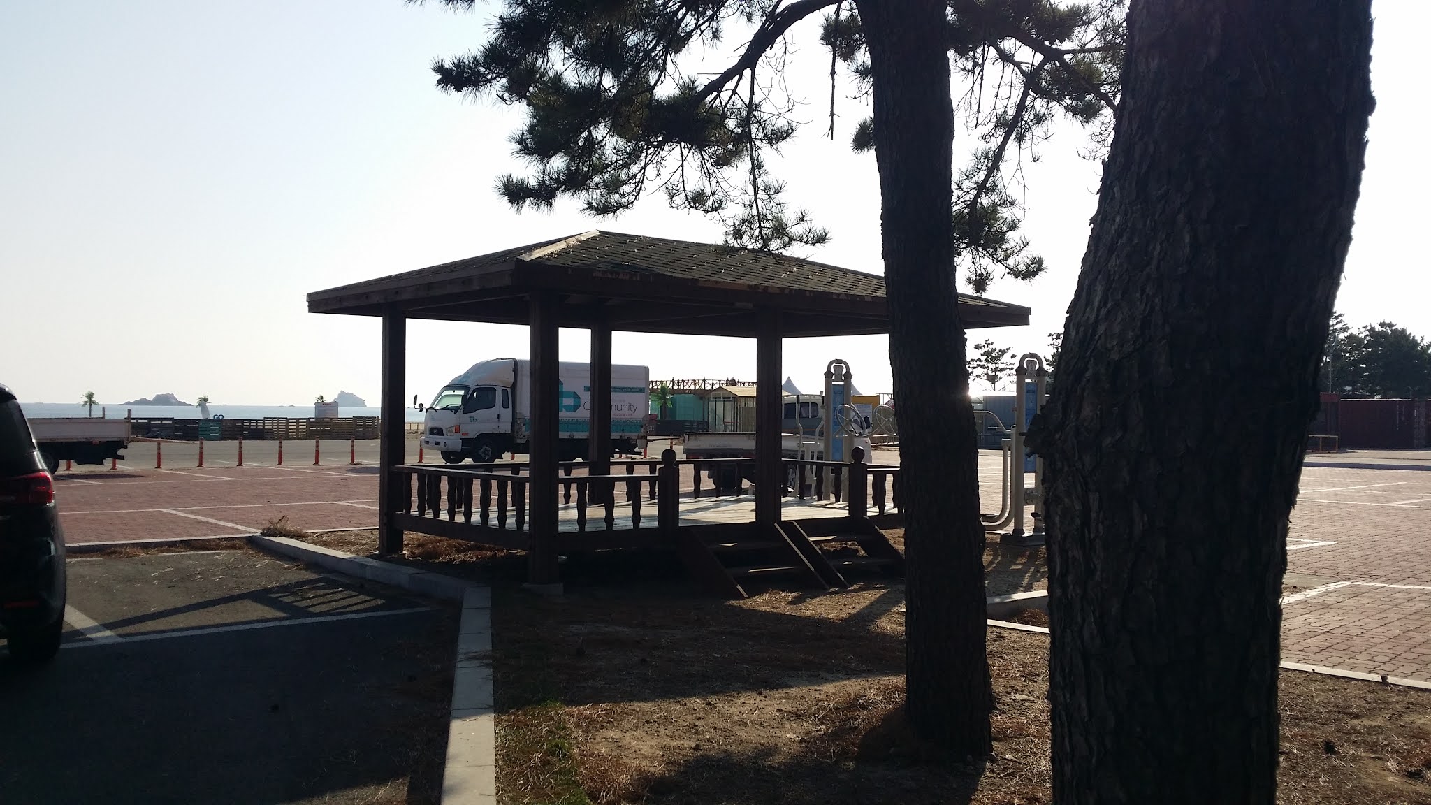
These platforms are found wherever there's picnicking or camping to be done:
The Eiffel Tower got high, changed its hair, and fucked a water wheel—
More defensive concrete blocks, ready to tumble on down:
A very nice path, except that it went parallel to a noisy highway:
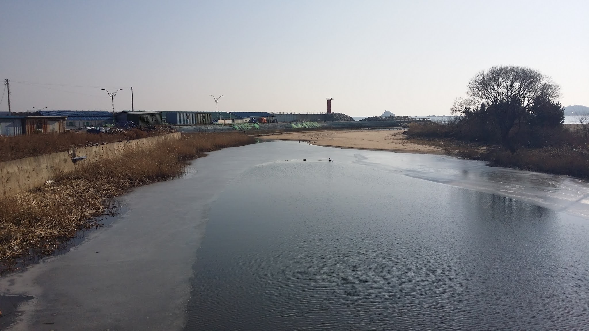
The path runs alongside Lake Songji. I was fascinated by the number of seaside lakes I encountered over two days' walking. It's the sort of thing an ecologist revels in: freshwater biomes next to saltwater ones:
Lake Songji Observation Tower (송지호 관망 타워):
The path veers left and east, toward the ocean:
An expensive-looking hotel:
Ironic contrast: "safety line" tape and the freedom of the open sea:
No shortage of sickeningly cute, kitschy, tacky things:
Not quite the crystal waters of Hawaii, but that'll do, Pig:
A rather "meh" shwimteo:
Apparently, a small rock-climbing wall is called a "bouldering wall":
Sigh... yet another sign talking about the restrictions in place until January 3:
The pic below shows the last gasp of a creek—a manmade channel to facilitate the fresh water's flow. I was crossing a small bridge when I took the following photo; on the other side of the bridge, the creek was still visible, but the water was too low to have the force to flow all the way out to the sea. This is what disappointment and lack of fulfillment look like:
Holy shit—a glove!! My first on this trip:
I had been passing these "Goseong County" manhole covers for miles, so I finally decided to take a picture of one before I left the Goseong area:
I fantasized a few times about having the money to build myself a typhoon-proof house on one of those rocky offshore islands:
Artwork abounded:
Charlie Brown's bare-bones Christmas tree before the kids spruced it up?
The world's hairiest shwimteo:
Baekdo Beach:
I was drawn to the octopus:
Pixar recently did a movie about this, didn't they?
Rainbow barrier:
Awww... a cute little tableau of a lesbian kiss:
For all you lovers of Among Us out there:
Where are the other 99?
I think this is a bassist, but I still thought of my brother Sean, the cellist:
Freeeedoooooom!!
I saw the following sign on the wall of a restroom. Basically, it says that smart people don't throw their cigarettes and spit their mucus-y wads onto the floor. Treat the restroom as your own, and throw your trash in the trashcan!
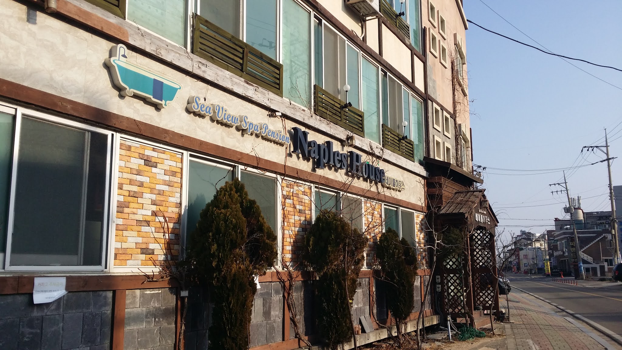
I'm curious as to what separates the "house" from the "pension":
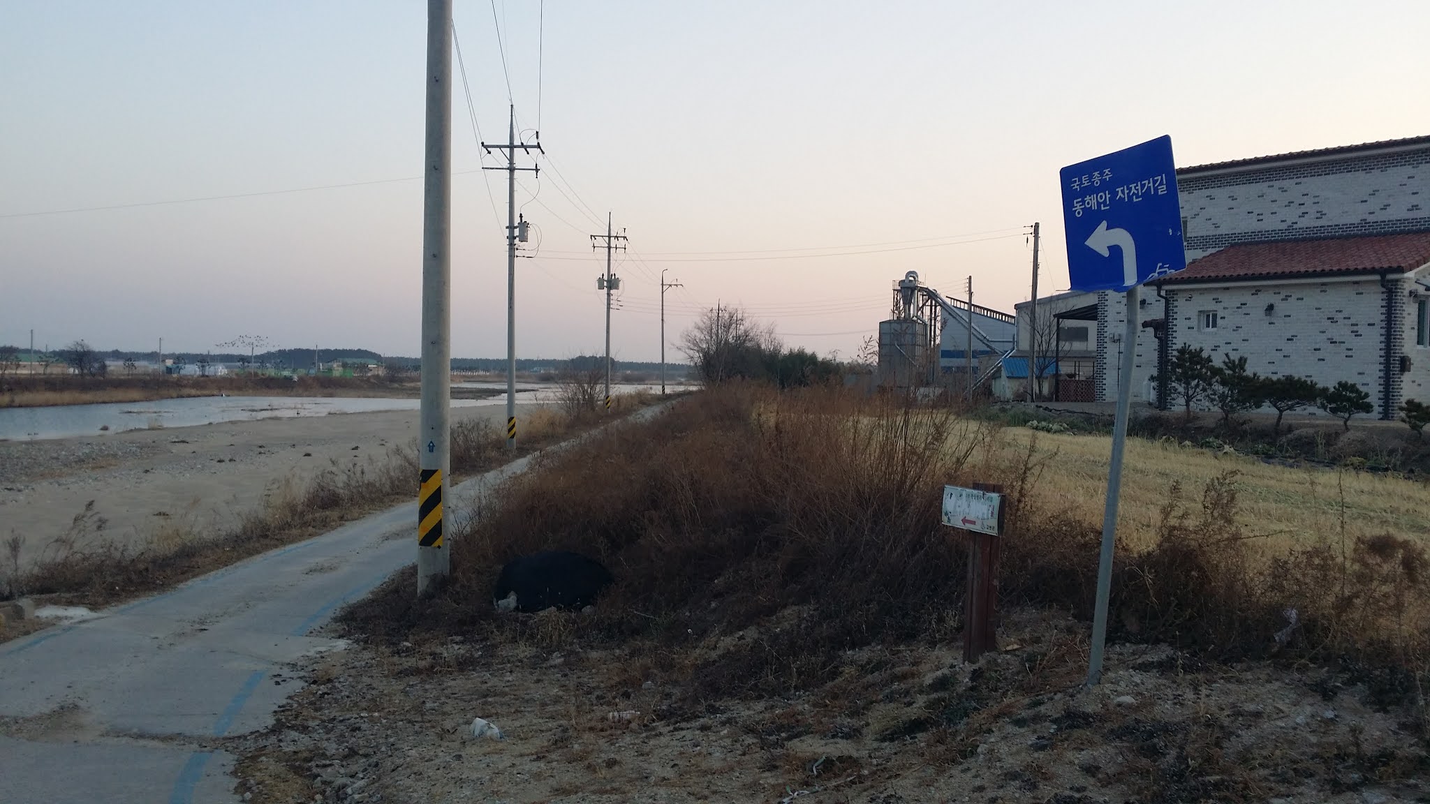
The photo below marks the moment I made my final transgression, ignoring the "do not enter" sign so as to keep following the bike trail:
Here's the spot where I started to get nervous. That's a military facility off to the right, behind the trees. You don't really want to take photos of such places. This region is super-sensitive about spies and spying:
The tantalizing pagoda-thing on the ridge, however, looked photographable:
I'm about to leave the restricted area that I've been walking through:
And just when I think I can pick up the path again, I see that this new section is also taped off. Goddammit. This is about where I started to think about giving up. What's the point in walking this path if you can't actually walk this path?
It was right around this time, while standing at yet another blocked entry, that the thought of giving up resolved itself into certainty:
Once again, the sign blames restrictions on typhoons:
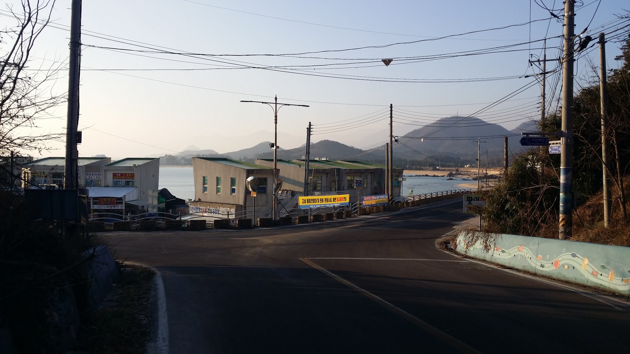
So I've re-plotted my course and am now heading directly toward the day's goal, which is a certification center just a few kilometers from here:
Doing the thing I didn't want to do—walking into town:
This is the northern reach of Sokcho, by the way:
Another dog sculpture, this one being anatomically correct:
I kept seeing the word geoneomul (건어물, pronounced somewhere between "gawn-aw-mool" and "gunn-uh-mool"), so I looked it up and slapped my forehead: I should've been able to figure out it meant "dried fish." I knew "건/geon" from geon-podo, i.e., raisins (dried grapes). I knew "어/eo" as the Sino-Korean word for fish.
Sometimes, seeing familiar things collocated in different ways can throw you off, especially if your Korean vocabulary is fairly limited even after sixteen years in country. Still, I should've fucking known what geoneomul was:
I so often fail to get pics of bikers on funky vehicles, but this pair of recumbent trikers came at me slowly enough for me to have the wit to take their photo:
Yet another one of many lighthouses, plus a pile of those gigantic concrete Tinkertoys that line the Korean coast. When I first came to Korea in 1986, those areas weren't fenced off, and I was able to scurry across those concrete piles fairly nimbly. Now, I'd likely twist or break an ankle:
I need to look up the correct term for these concrete caltrops. Ah—a quick Google search, and I see they're called tetrapods:
More fucking signage:
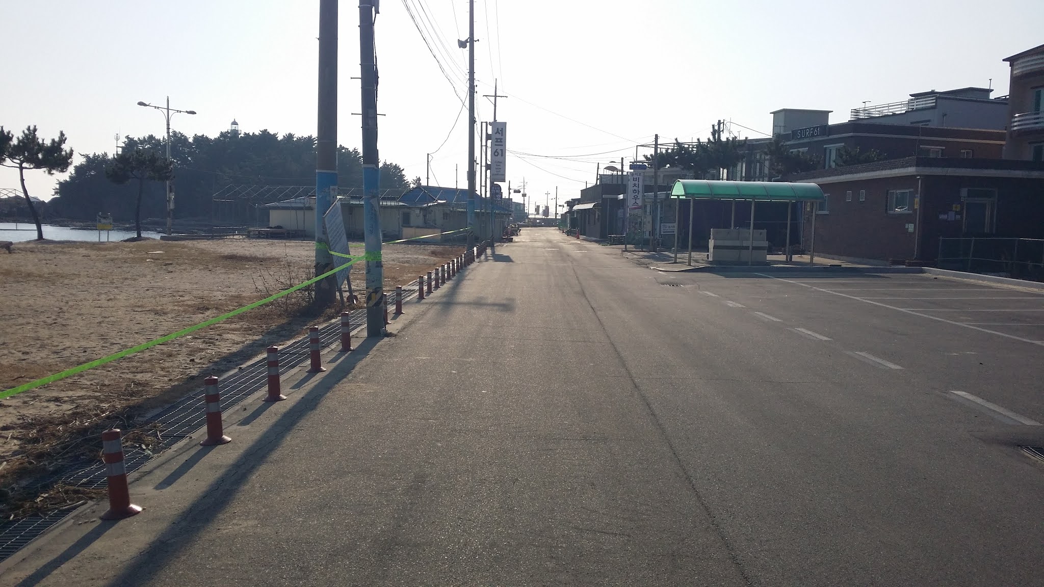
This boardwalk, below, represents the final stretch before I reach the Bongpo Beach Certification Center to get my first and only cert stamp for the day:
When I visited Virginia Beach, I'm pretty sure I remember seeing a glassed-in, built-out restaurant much like the one in the photo below:
A beach with a Western name:
And just to highlight the British-ness of the name "Kensington," a Routemaster double-decker:
Glamping, which I find vulgar:
And at long last...
I'll end with this shot: the second abandoned glove I saw:
So there were plenty of interesting sights to see during this walk, but as you can tell, my focus, this time, wasn't so much on nature's beauty as on the works of Man. And the works of Man don't really hold a candle to nature's beauty. Will I end up doing the east-coast walk in October? Will I, indeed?